


KUTHUPARAMBA MUNICIPALITY
1
28
197
3468
164
33
Kuthuparamba is closely related with Kottayam dynasty. Old Kolathunadu kingdom was an area lying spread between Korappuzha in the south and Kasargod in the north. Since the British captured Kuthuparamba area, the area fell under British rule was formed as Kottayam taluk. Agriculture was the main occupation of the people, but now it has been reduced very drastically due to overall growth in the economic condition. Kuthuparamba have a leading role in the war which happened between Tippu sulthan & British Government. The Thalassery – Coorg road which was made by the British for sending troops to Mysore also plays an important role in the history of Kuthuparamba. Kuthuparamba was formed as Panchayath in the year 1939 by fixing Kuthuparamba revenue village as its boundary. The first president of the Panchayath was Dr. C. Kumaran and Sri. V.K.Chandu was the last President of Kuthuparamba Panchayath. Kottayam dynasty had given much importance to the fine arts of Kathakali and Koothu. It is believed that the name Kuthuparamba was derived from the words ‘Koothu’ and ‘paramba’ (the ground where the Koothu was performed). This name was given to the complete area by British Military, there was a cantonment and was known as Kuthuparamba Cantonment. Now also there is some land owned by Military in Kuthuparamba. The remnants of past history are still alive in the structure like Court complex, Inspection Banglow, Maroli ghat
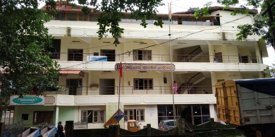
Kuthuparamba is one of the main town and a municipality in the Kannur district. Kuthuparamba was established as municipality on 01.04.1990.Kuthuparamba is a main town, even though the village behaviour persists. Kuthuparamba is the place having a total area of 16.76sq.km. The Kuthuparamba cantonment of the British Raj was located here. The Indian Army holds land here. As of 2011 India census, Kuthuparamba had a population of 32425. Males constitute 45% of the population and females 55%. Kuthuparamba has an average literacy rate of 96%, higher than the national average of 59.5%: male literacy is 87%, and female literacy is 84%.The Kuthuparamba Municipal building is situated in the Thalassery Coorg road which connects to Karnataka. Kuthuparamba act as a hangout for those travelling to Mangalore, Mysore, Bangalore and Wayanad. The famous Valiyavelicham industrial sector is only 6 km away from Kuthuparamba Municipality. The upcoming Kannur international airport is only 15 km away from Kuthuparamba.
Total Population=32425